Aerial Image Segmentation
Image segmentation is key to distinguish the various elements that are in a visual scene. Common models are trained on frontal views, which does not work for aerial images. To train a model for aerial images, a lot of labeled images are required, and labeling of segmentations is time-consuming.
We propose to make clusters of image segments and to label only those clusters. The clustering is based on spatial feature maps, taken from intermediate embeddings of a self-supervised model. Labeling clusters is very easy and takes almost no time.
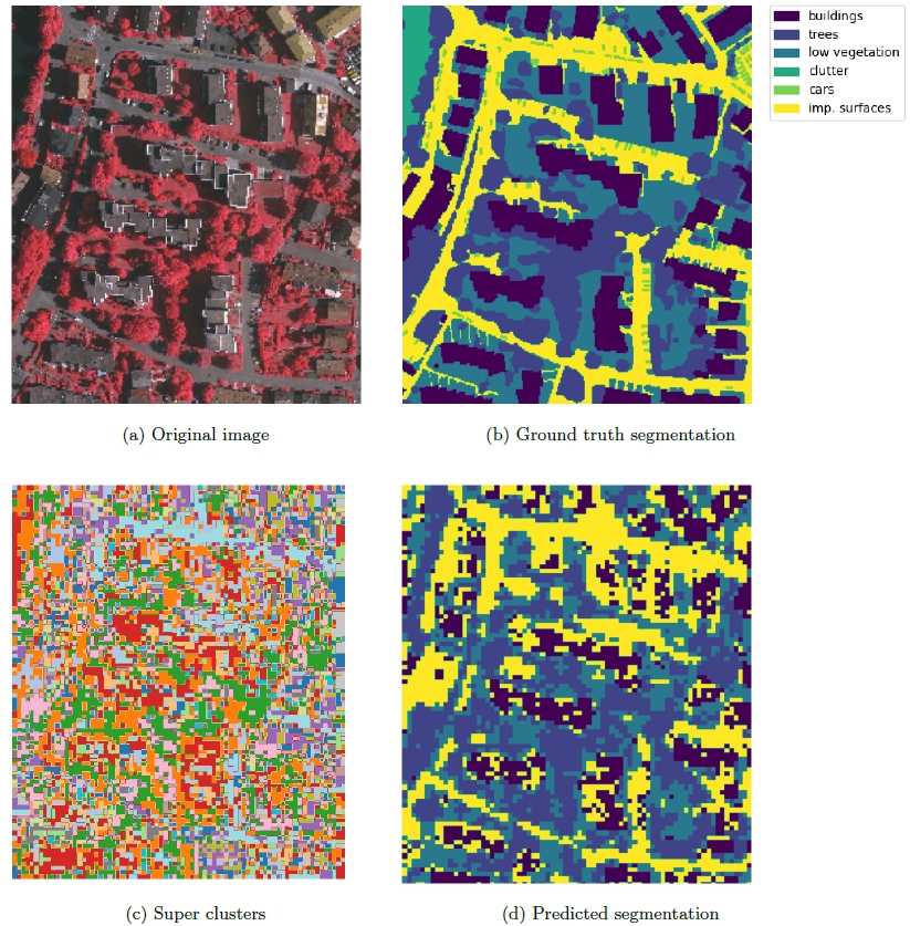
Here you see a result of 50 such labels. Not perfect, but already useful, while only requiring a few minutes.